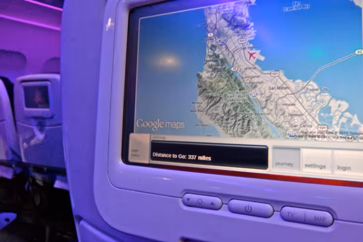
Travellers flying with Virgin America will soon be able to take advantage of a brand new entertainment platform with a completely revamped Google Maps interface, all from the comfort of their aeroplane seat.
Posting on the Google Lat Long Blog; Jesse Friedman, Product Marketing Manager at Google, announced that as an ongoing partnership with Virgin America, travellers will be able to view exactly where the plane is situated, zoom-in, plan and explore the terrain around the planes location using a built-in Google Maps application.
The maps have been given a facelift, allowing the user to highlight mountains, elevations and other natural features.
The announcement comes directly after Virgin America’s press release stating that the airline company has just submitted an order for 60 extra aircraft, tripling the size of its fleet to fly passengers to a number of new destinations.

The 💜 of EU tech
The latest rumblings from the EU tech scene, a story from our wise ol' founder Boris, and some questionable AI art. It's free, every week, in your inbox. Sign up now!
If you get a chance to see the new map features, let us know your thoughts.
Get the TNW newsletter
Get the most important tech news in your inbox each week.