Earlier this week, we reported on how New Orleans’ renewal was being capture on Google Street View as the Internet giant rolled out updated imagery.
This followed shortly after 10 Downing Street finally landing on Street View, while Antarctica recently got a massive update with 360-degree panoramic snapshots. And now it’s Brazil and Mexico’s turn to receive a slew of imagery updates.
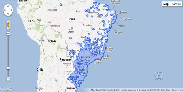
While Brazil first got Street View way back in 2010, starting from this week more than seventy cities across Brazil (it’s a big country) will receive panoramic images, with the likes of Fortaleza and Brasilia (Brazil’s capital, you may be surprised to learn) on its update list, alongside coastal hotspots such as Recife, Natal and Salvador.

The 💜 of EU tech
The latest rumblings from the EU tech scene, a story from our wise ol' founder Boris, and some questionable AI art. It's free, every week, in your inbox. Sign up now!
Given that Brazil will be hosting the 2014 football World Cup, and then the Olympics two years after, many tourists will surely find a use for this. But perhaps the biggest event of all – The Next Web’s conference in São Paulo – is taking place only next week.
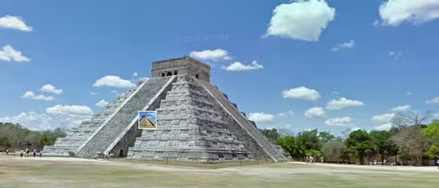
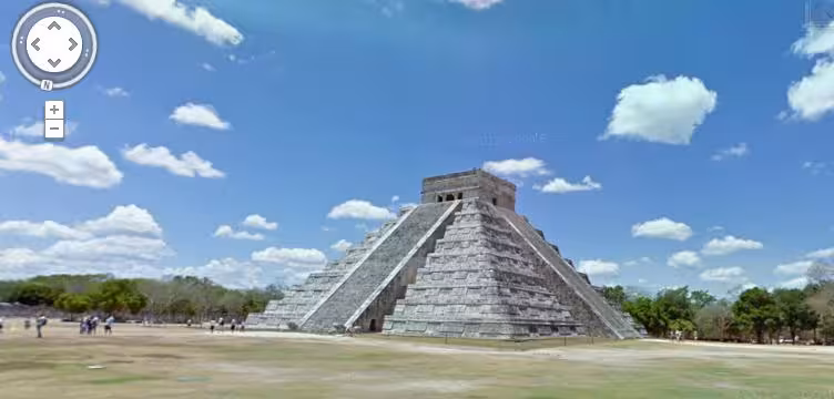
As for Mexico, well, Street View imagery of thirty Mesoamerican archaeological sites have been added, with the likes of Kukulkan’s Temple added to its repertoire. There’s also the pyramids of Teotihuacan and Chichen Itza.
Get the TNW newsletter
Get the most important tech news in your inbox each week.