Less than a month after Google rolled out one of Street View’s biggest ever updates with 250,000 miles of roads globally, the Internet giant is hitting the slopes with its latest update by adding some of the world’s most well-known ski runs.
It’s almost a year ago to the day when Google added another slew of slopes to Google Maps, including Squaw Valley in California. Now, another load have been added from across Europe (e.g. Switzerland, Norway, Austria, Italy, Sweden and Spain), Canada (e.g. Blue Mountain, Lake Louise and Fernie) and the US (e.g. Utah and Michigan).
You’ll now be able to take a peak (yup) at the likes of Switzerland’s St. Moritz or Zermatt.
 However, the latest Street View update is particularly notable for another reason.
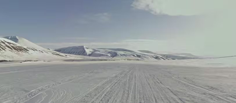
Back in July, Google ventured to Antarctica which was its its furthest southerly foray, but with its latest update comes its furthest northerly coverage.
The first ever imagery of Svalbard in Norway, an archipelago sitting 400 miles north of the European mainland, is now available on Street View. Svalbard is also home to the Svalbard Satellite station, used by the likes of NASA and the ESA.
It’s also worth noting that Google Street View also some new imagery from the ice roads in Estonia, which are only open when the weather permits and the ice is thick enough. “We were lucky enough to capture the 10km ice road from Rohuküla to Sviby and the 3km stretch from Haapsalu to Noarootsi, among others,” explians Ulf Spitzer, Street View Program Manager.

Get the TNW newsletter
Get the most important tech news in your inbox each week.