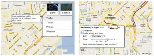
Google has today announced that it is expanding typical traffic pattern mapping service to include regular roads, not just highways. It has always provided the service on highways, but now arterial roads (major gateways of traffic) are also covered.
If you enter a set of destinations and enable the traffic layer in Google Maps, you will now see both live traffic and traffic patterns at a given time on both arterial roads and highways. This will allow you to more accurately plan your route from one place to another in order to avoid running into heavy traffic.
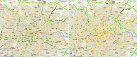
The before and after shots of London below show just how much more traffic data is available to travelers:
The expansion of the traffic pattern service to arterial roads follows the introduction of traffic data to the travel duration time on Google Maps just a few days ago. It uses various bits of data, including some gathered from the My Location feature on Google Maps for Android as a part of its crowd-sourced data gathering efforts.
Get the TNW newsletter
Get the most important tech news in your inbox each week.


