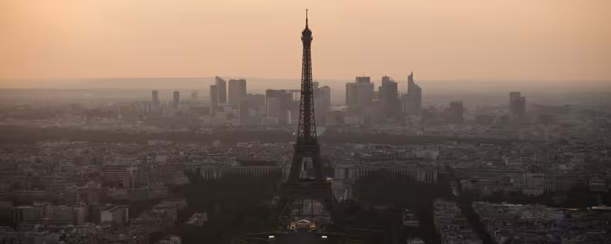
Google has extended its Street View imagery to the top two viewing decks of the Eiffel Tower for the very first time, giving users a breathtaking view of the Parisian skyline from the famous French monument.
The Eiffel Tower is the most visited monument globally – some 7 million people visit and ascend the monument each year – but Google is now opening the iconic structure up to absolutely everyone on the Web.
Google employees took the Street View trolley, an image capturing device that looks exactly as you would expect, to both the second and top floors to capture the entire circumference of the viewing decks with all-new 360-degree photographs.

The 💜 of EU tech
The latest rumblings from the EU tech scene, a story from our wise ol' founder Boris, and some questionable AI art. It's free, every week, in your inbox. Sign up now!
The results are breathtaking and still trigger an inevitable sense of awe; it was the highest monument in the world for 40 years, although that title is now held by the Burj Khalifa in Dubai – a building which Google has also scaled for its Street View image library.
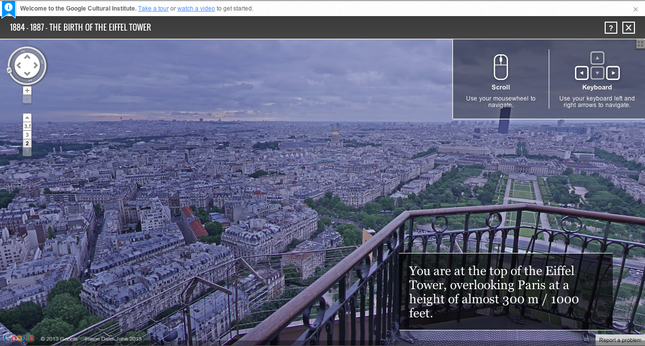
The Google Cultural Institute has also partnered with the Eiffel Tower Operating Company to create three digital exhibitions which blend these modern-day panoramas with nearly 50 historical illustrations, plans, engravings and photographs.
Entitled ‘The Birth of the Eiffel Tower’, ‘The Eiffel Tower’s Inauguration and First Visitors’ and ‘The Construction of the Eiffel Tower’, these short presentations offer an informative and entirely accessible insight into how the monument was built.
Users can move between the slides by using the left and right arrow keys, or scrolling with their mouse or trackpad. Text boxes are short but to the point, offering a brief overview with engaging animations and slide transitions.
“As a product manager and designer, it’s been awe-inspiring to get to see the spectacular vision and the detailed architectural capabilities exemplified by the plans more than 100 years ago,” Mark Yoshitake, Head of Product & User Experience, Google Cultural Institute said. “It required tremendous knowledge of special planning and physics to ensure that 18,000 separately made pieces would come together as one.”
There’s few places that Google hasn’t ventured to improve its bank of high-resolution panoramic images. The Galapagos Islands, the Antarctica and Svalbard – which is 400 miles north of mainland Europe – are just a few of the more unusual places ticked off the list.
Google Maps is often seen as a navigation tool, but Street View imagery such as the fresh batch released today show its educational and informative applications.
Image Credit: FRED DUFOUR/AFP/Getty Images
Get the TNW newsletter
Get the most important tech news in your inbox each week.