Flickr has partnered with Finnish telecommunications giant Nokia to bring improved mapping and geotagging to its millions of users around the world.
The Yahoo-owned image and video-hosting service has announced that whilst it has always enabled photo geotagging, it has sought to introduce a higher quality of maps by tapping Nokia’s map style and satellite images.
“Whether you’re geotagging one of your photos, discovering places, or simply want to see where other people’s amazing images were taken – you’ll see up-to-date maps from one of the largest and best mapping providers in the world,” says Markus Spiering, Head of Product at Flickr. “Our new maps will provide you a much greater level of detail and let you zoom in much further than before.”
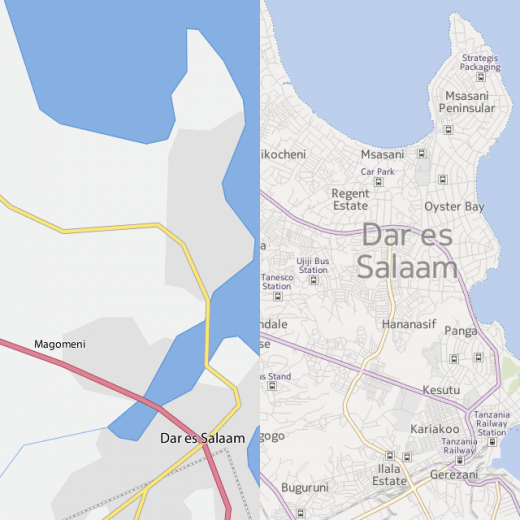
However, Flickr won’t be dropping its work with the Open Street Map (OSM) community – it will continue to reel in OSM map tiles for areas where full commercial map coverage isn’t available.
“One amazing thing about Flickr is that you travel all across the world and take photos,” continues Spiering. “We need to have the best maps – even in the most exotic places – and partnering with the OSM community allows us to give you high quality maps everywhere.”
Geotagging lets users add the location information to media assets such as photos. You can geotag your photos using Organizr, or directly from within the individual photo pages.
Microsoft too recently announced a deeper tie-up with Nokia, with the Finnish mobile behemoth powering the traffic feature in Bing Maps, whilst geocoding data was to be integrated too. And Microsoft also recently revealed that it was switching from Bing to Nokia Maps in Windows Phone 8, for turn-by-turn directions and offline access.
The new maps will be made available for Flickr users everywhere as of today.
Get the TNW newsletter
Get the most important tech news in your inbox each week.
