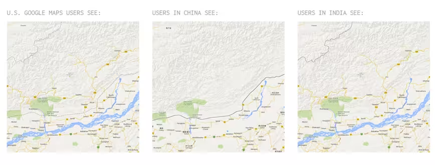
Google Maps almost caused a war between Nicaragua and Costa Rica back in 2010, so it’s clear that border disputes are a sensitive issue. Earlier this year, the Washington Post revealed Google’s unique way to appease all sides — it shows alternative versions of disputed borders to different sides — and now there’s a website that visualizes the differences.
Disputed Territories — a product of a recent Knight-Mozilla-MIT hackday, which was first noted by Quartz — shows the various iterations of sensitive borders, such as Crimea, by comparing them side-by-side.
If you’re a maps or politics geek, or simply just the curious type, it’s well worth a look.


The 💜 of EU tech
The latest rumblings from the EU tech scene, a story from our wise ol' founder Boris, and some questionable AI art. It's free, every week, in your inbox. Sign up now!
Related: Detroit’s apocalyptic downturn visualized using Google Street View
Get the TNW newsletter
Get the most important tech news in your inbox each week.