If you like maps, data and funky graphics you might like this.
For the past year, UX designer Peter Smart and former Mozilla technical evangelist Robin Hawkes have been working on a project called ViziCities, an open-source platform that creates 3D visualizations of cities around the world. The code was finally added to Github this past weekend under an MIT license, with a view towards encouraging third-party developers to do cool stuff with it.
So what exactly is ViziCities all about, you ask?
Well, as luck would have it, Hawkes and Smart put together a demo of the kinds of things you can do with it, but it is still quite early-stage and it’s more about getting a feel for what it looks like. Indeed, it uses JavaScript and WebGL for rendering, which is fed with OpenStreetMap data for geographic entities, covering streets, buildings, bodies of water (rivers, canals, etc), and green areas. Given that OpenStreetMap covers much of the world, there is a lot of scope for creating cool and useful Web applications and tools here.
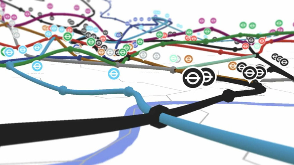
However, it’s not just about reimagining cities in 3D – data is the name of the game here. To give you an idea of what’s possible, the guys previously built a live visualization of the London Underground in 3D, as well as the London bus network. Check this video out:
In future iterations, ViziCities will also include things like real-time public transport flows that show traffic traversing conurbations. Similarly, they plan to throw social data into the mix too, so you could visualize tweets or maybe even Instagram photos flying out of cities. Just like this:
Longer term, there’s a lot of potential in this project, and it will be interesting to see where it goes from here.
“We’ve already been in touch with Data.gov.uk, TfL, Code For America, IBM, and others about how they could use our platform to improve things for citizens of cities around the world,” says Hawkes.
ViziCities is one to watch for sure.
Get the TNW newsletter
Get the most important tech news in your inbox each week.