Google has just announced a small but significant update to its maps.
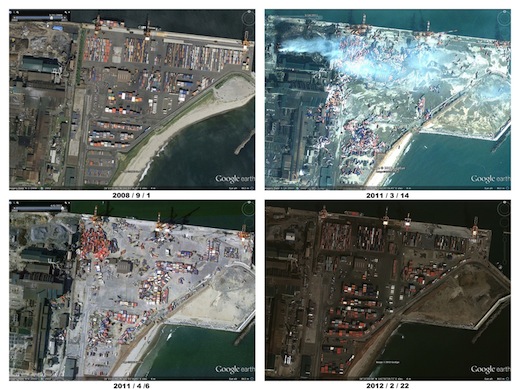
Exactly one year after the earthquake and tsunami that devastated Japan, satellite images on Google Maps of the country have now been updated, to reflect progress made in the recovery over the past year.
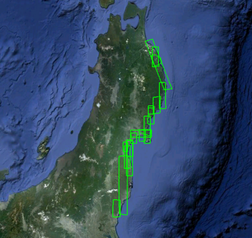
The new images, covering the entire Northeastern coast of the island, were taken in February and March, and give insight into how the area has changed.
Available both on Google Maps and on Google Earth, to see the images for yourself, just navigate to the area on the map and switch to Satellite view. Some of the areas that have been updated include the Bridge of Minami Sanriku Town and Shiogama Port, both in Miyagi.
According to Google, Japan’s recovery from the tsunami is far from over:
“Since the earthquake and tsunami last March 11th, we have been updating satellite and aerial imagery of the area to show the effects of the disaster as well as the pace of rebuilding. The new imagery shows that the road to full recovery is still long. There are, however, signs of progress — from large trucks on the streets to newly repaired bridges and bustling ports.”
Google also reminds us that, using the Follow Your World to receive notifications when images in one of the most significantly damanged areas, Tohoku, are updated.
Get the TNW newsletter
Get the most important tech news in your inbox each week.
