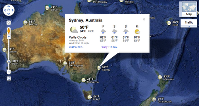
It’s usually a two-step proces for me. I first check Google Maps to get directions, then I look at Weather.com or some other service to find out what I’ll need to pack. Now, with an addition to Google Maps, I get to cut out one of those steps:
Weather comes in a layer, just like everything else in Google Maps. If you want to see it, you’ll need to hover over the right corner of Google Maps and select Weather from the dropdown menu.
Once you do that, you’ll get weather overlayed at any location you choose. Selecting a specific point will give you an information window that gives a forecast, as well as current conditions:

There’s not much else to say here, other than it’s a handy addition to a tool that you probably already use. We like those.
Get the TNW newsletter
Get the most important tech news in your inbox each week.


