From today, London travelers can get public transport directions within Google Maps.
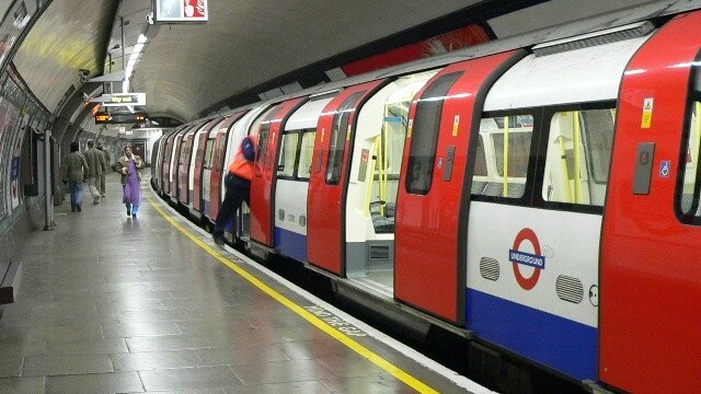
Google made the announcement earlier today, and the 1bn+ passengers that use Transport for London (TfL) services each year, covering 18,000 bus stops and 250+ Underground stations, can now obtain transport options as well as navigate the streets – entirely within Google Maps. This will be a welcome addition for those who previously used Google Maps in conjunction with TfL’s Journey Planner to find their way from A to Z.
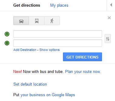
As you can see, there’s a new ‘train’ icon and a ‘Plan your route now’ link, incorporating bus and Tube, in the ‘Get Directions’ pane within Google Maps:
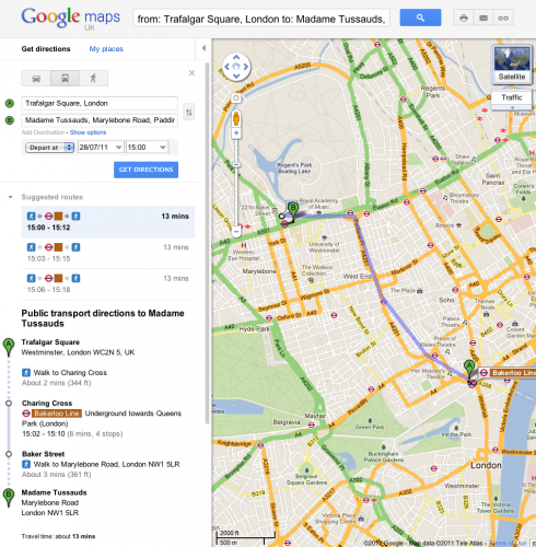
To use the service, simply go to Google Maps, click ‘Get directions’ in the left-hand panel, and then hit the train icon to see public transport directions. Enter your departure and destination points as requested, and when you’re done, click the “Get directions” button and you will then receive suggestions for your trip:
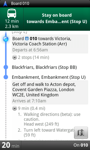
Public transport directions will also be available for Google Maps on mobile devices, and it uses your current location to determine the best journey towards your destination.
On Android, which is a Google-owned operating system, you can also receive transport directions with Transit Navigation (Beta) in Google Maps, which we reported earlier this month as a new feature on Google Maps 5.7, meaning you’ll get alerts when you have to get a transit connection.
This integration was made possible because TfL made its timetable information publicly available in September last year, meaning that anyone can access its data and develop their own travel information service. We’ve previously written about BusIt London, a dedicated app for traversing the UK capital by bus. And last week, we reported on TubeTap, an app that uses TfL’s data to help commuters claim refunds if there are delays.
Get the TNW newsletter
Get the most important tech news in your inbox each week.


