Although the space race between Bezos, Branson, and Musk dominated the headlines last year, the growing SpaceTech revolution will be about more than billionaires blasting off to space in dildo-shaped rockets.
Rather than seeing who can go furthest (or who’s got the bigger rocket), the much more quiet revolution will be about looking inwards. The democratization of satellite monitoring and data is bringing about a new era in which technologies like geothermal heat mapping, satellite-based IoT capabilities, and risk mapping can be harnessed by individuals to solve our most pressing problems here on Earth.
A slew of ambitious new startups are looking at how we can use this developing technology to tackle food security in a sustainable way, provide new tools for peace and conflict resolution, and protect the environment.
We spoke with five up and comers from the X-Europe accelerator program to find out more about how space technology could be used for good on our home planet.
Food security for small-scale farmers
Climate change is swiftly reshaping the Earth’s weather patterns, resulting in higher instances of drought, new pest swarming patterns, and, in some cases, flooding. For small-scale farmers in Africa, these changes have been particularly acute. According to Johannes and Jakob Röhrenbach, founders of Mavuno Technologies:
African countries still carry the burden of agricultural production which is much lower than its potential; 80% of African agriculture is carried out by smallholder farmers. By making the benefits of earth observation techniques accessible to African smallholder farmers we could therefore realize massive production gains and at the same time support a customer segment with very low average incomes (of < $1,000 / year).
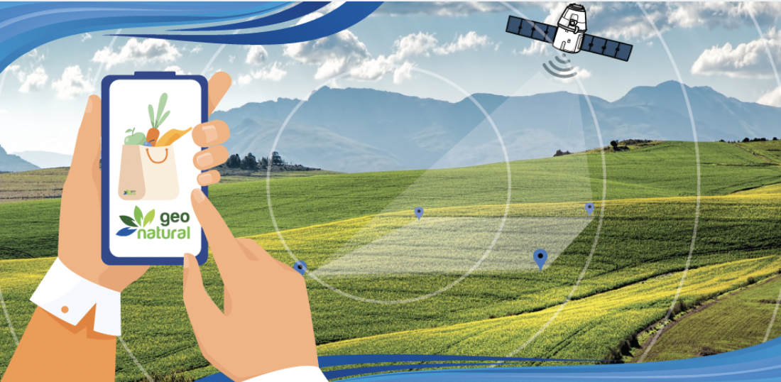
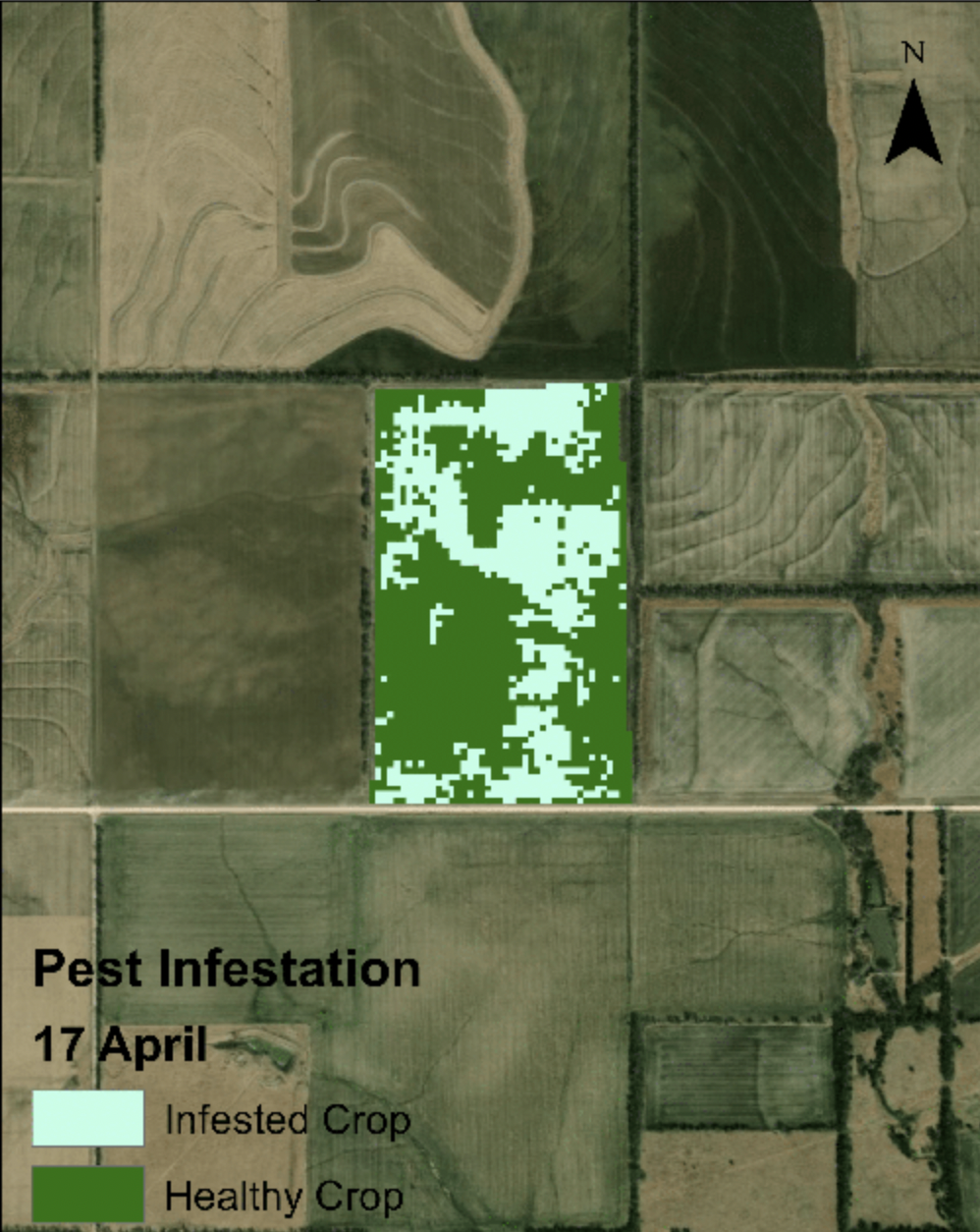
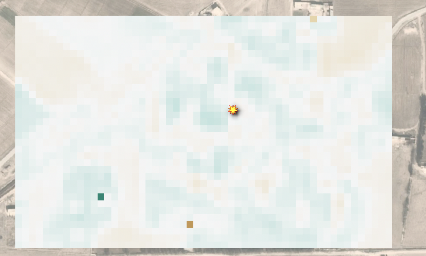
With the help of satellite imagery and machine learning, Jakob and Johannes started Mavuno Technologies, a company whose mobile app can help farmers increase their harvest yields. By displaying crop status as heat maps, these farmers have the data they need to make more informed decisions on fertilizer application, irrigation, pesticides and herbicides. The Mavuno app utilizes leading edge open-source Sentinel-2 satellite data from the European Union’s Copernicus earth observation program to make this happen. Röhrenbach says:
In the field of agriculture, SpaceTech such as satellite imagery applications can massively reduce the need for farming inputs thanks to much more precise treatment. Applied to African smallholder farmers, the dense data profiles obtainable through satellite imagery additionally serve as risk management measures to help farmers access microfinancing in order to fund better farming techniques.
In 2021, Mavuno helped 600 Tanzanian cashew farmers double their harvest yields. From this year on, they’ll also be able to measure harvest yield increases through a specialized prediction model.
After this successful proof-of-concept, this year it is conducting its first experiment in Kenya, and preparing to expand to more East African countries in the future.
Combating organic food fraud
Green EO is another startup leveraging satellite technology in the agricultural sector, but its focus is on building a strong and transparent organic food industry. According to CEO Reaid Alam, as demand for organic products has grown, so has what’s called ‘organic food fraud.’
Eating organic is a novel intention. Organic consumers are not only considering their health but also the planet. In this case, if the food is not truly organic, the consumers are being cheated. Information about organic products should be complete and traceable for consumers so they can understand the value of their money.
While those oranges you bought last week may carry an ‘organic’ label, the lack of food traceability, monitoring, and supply chain transparency has allowed non-organic products to filter in, until now.
Using a combination of satellite imagery, machine learning, and artificial intelligence, Green EO is providing the technology that certification and accreditation bodies need to ensure compliance.
They also work with farmers and farmer associations providing a crop pest management API and verification services. This can help level the playing field for organic producers. Alam says:
Organic farming always aims for sustainability. So, when organic food fraud occurs, it creates unfair competition between organic and conventional farmers. A lot of time and effort needs to be spent on growing organic crops compared to the same conventional crops.
Creating sustainable and humane conditions for livestock and fisheries
As the population grows at a rapid rate, food security will be a major issue. At the same time, to meet increasing demand, we’re seeing increasing instances of poor treatment of livestock within the farming industry. Meanwhile, overfishing is decimating both fish populations and, as a result, the sustainability of the ocean’s ecosystem.
This raises two different questions: How can the agriculture and fisheries sector create more sustainable and humane conditions for livestock and fish populations? And how can consumers ensure they’re selecting products from companies following sustainable practices?
FOSSA Systems, a company that provides satellite-based IoT solutions for a wide range of industries, has an answer. Elena Vélaz, the company’s marketing and sales manager, explained that satellite-based IoT connectivity and the use of sensors and nodes allows farmers and fisherfolk to track and get a reading on these animals in real-time, even in areas with little to no connectivity.
By placing a sensor on each head of cattle, we can gain deeper insights into the status of each animal, find out if it has an accelerated heart rate, which indicates stress or illness, if its body temperature is abnormal, or if it has been standing still for a long time in one place, which can be a sign of death, helping the farmer to take actions in advance.
Like Green EO, Fossa also uses its technology to enable consumers to trace the origins of the products they buy. This gives shoppers the power to choose animal products from businesses that follow humane and sustainable practices.
“With a simple QR code located on the label, the consumer can access information about the origin of the product, when and how it was packaged, its logistic path from the factory to the supermarket shelf… This information will help the consumer decide more consciously which product to buy, promoting the consumption of those products that fully respect the environment,” Vélaz shared.
Monitoring conflict zones
Beyond agriculture, SpaceTechs startups are also looking into new applications for satellite technology. One growing area is in peace and justice.
Space4Good has been a pioneer in this field, collaborating with governmental bodies, international organizations, and NGOs to provide the satellite imagery technology these actors need to keep people safe, and even find new ways to prevent conflict.
One of the first pilot projects the startup conducted in this field was with the HALO Trust, a UK based NGO focused on demining active and inactive conflict zones. As Space4Good’s founder, Alexander Gunkel explains:
Explosives can continue to cost human lives weeks, months, or even years after they’ve been deployed. HALO Trust is clearing leftover ammunition to protect people who are returning home after the fighting stops. While working with them, we realized there was a lot of space for innovation using satellite earth observation.
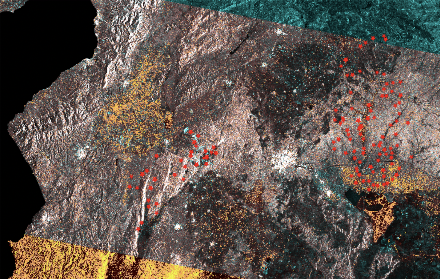
They then undertook a second pilot with the Carter Center focused on identifying potential proxies and creating a risk map for UXOs (unexploded ordinances) in Syria.
Unfortunately, you can’t see the actual barrel bombs with satellite imagery but you can consider where they might be based on change detection in urban areas.
According to Gunkel, 10-15% of explosives don’t explode on impact, meaning that identifying changes in surrounding structures such as buildings can give a better idea of where the heaviest bombings took place, and thereby where the highest potential is for UXOs.
And demining is just one area where this technology can be put to use. Space4Good is now also working on a project with the World Bank to understand the connection between climate change and social unrest. How do climate change events (and particularly drought) affect the sentiments and actions of local populations? This is very important information for development banks, peacebuilding organizations but also insurance and asset managers.
Another area is conflict resolution. For example, conflicts between different groups can often arise when herds of cattle move into and impact other communities. Satellite imagery can help to quantify those effects for conflict resolution, and provide a new independent source of information for mediation entities.
Combined with Space4Good’s existing work on nature based solutions, the team aims to become the most trusted geospatial partner for impact leaders helping them to resolve social and environmental issues world-wide.
Environmental security
To combat climate change, we need to address, not just the effects (like drought and flooding), but the causes. Among many other applications, Aistech is using SpaceTech to provide local governments and other bodies with the data they need to monitor and prevent environmental damage.
By sea, Aistech is providing maritime authorities with the tools they need to detect piracy, smuggling, illegal fishing, waste dumping, and other illegal activities.
According to the company, illegal, unreported, and unregulated fishing activities (IUU) result in the estimated loss of 11-26 million tons of fish each year with a value of between $10 billion and $23 billion. These losses translate into adverse effects in terms of food security, employment, trade, and economic well-being for people around the globe. As Sofia Adalpe, Head of Business operations explains, without the right technology, this is an almost impossible challenge:
Coastlines are vast and authorities often lack the technical and human means to monitor and manage them. Further, connectivity in many maritime zones can be low or nonexistent.
To solve this challenge, Aistech Space is developing a maritime security system set to launch in June 2022 using its own high frequency thermal imagery. By combining thermal imagery with other sources such as emitted signals from declared vessels, users can identify and characterize legal versus IUU fishing activity along coasts. The platform will provide an estimation of the vessel’s size, position, and next movements, allowing authorities to respond in near real time.
Our first-in-kind high resolution thermal imager can use heat signatures to provide information about what vessels are doing in a way that’s not possible with Synthetic Aperture Radar imagery, and it can provide images independent of light conditions, which is not possible with visible imagery. Further, a constellation of 20 thermal-enabled small satellites (which it’ll launch over the next three years).
On land, the company provides services that allow clients to monitor deforestation and combat fire hazards in forests with near real-time early warning burnt area mapping and fire risk modeling.
Our first-of-a-kind high-resolution thermal infrared (HR TIR) satellite imagery can provide a more accurate and affordable map of wildfire risk at scale than is currently possible, enabling fire managers to see previously undetectable dry spots, and providing the best indicator of fire danger available. Aistech will enable the daily monitoring of entire forests with its first satellite at a fraction of the cost of traditional methods.
Learn more about these and other exciting new SpaceTechs that are taking part in X-Europe’s accelerator program for up and coming startups.
Get the TNW newsletter
Get the most important tech news in your inbox each week.
This project has received funding from the European Union’s Horizon 2020 research and innovation program under grant agreement No 871795.