HopStop is a New York City based website that provides directions via subway, bus or walking to and from anywhere you want to go in 37 cities around the world. As a busy 26-year old in the big city with almost no sense of direction, I use its slick iPhone app almost everyday. The site provides maps marked with nearby subways and bus stops (and restaurants, bars, clubs, hotels etc.), a taxi mode that estimates time and cost of travel and contact information for taxi companies, and the ability to re-route suggested transit plans. It even takes scheduled route changes due to construction and spontaneous subway delays into account.
Two days ago, I noticed that HopStop added a “calories burned” feature to its available routes. How curious, I thought! I can now enjoy that latte with 2 extra sugars if I take the J instead of the L… Just kidding. While at first the feature seemed more of a novelty, now it all makes sense. Beginning this week, HopStop now provides biking directions in the five boroughs of New York City, a feature that Google Maps added last March 2010.
For the first two months, the Equinox fitness clubs will sponsor HopStop’s latest feature, which will fittingly be presented alongside data about how many calories users might burn by pedaling different routes. As part of the sponsorship, users will be geo-targeted with ads including nearby Equinox gym locations.
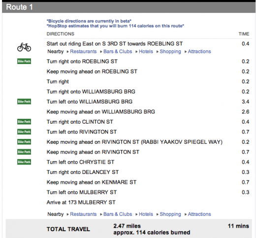
This is an example of HopStop’s latest biking directions and calorie count at the bottom, justifying the fact that every time I bike into Manhattan over the Williamsburg Bridge, I definitely deserve a class of wine:

Get the TNW newsletter
Get the most important tech news in your inbox each week.


