
You’re probably familiar with Google Transit Maps, especially if you live in an urban area. Earlier in 2009, Google added the Transit Maps feature as an overlay to Google Maps, highlighting available public transit in metro centers.
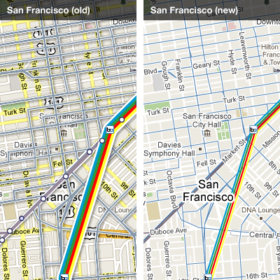
The issue with Transit, and why I never used it after moving to Nashville, was clutter. The map was just a mess, because it highlighted the roads as a normal Google Map would, but then layed the public transportation options over the top.
According to the Google LatLong blog, that is no longer an issue. Transit now has its own dedicated system, where public options are brought to the front. Though you can still see the roads as before, they are now shown in a much lighter contrast and are not nearly as invasive.
Have you tried the Transit layer? Take a check to see if your area is supported, and let us know what you think. Have a look at some Google screenshots, showing the before and after.
Get the TNW newsletter
Get the most important tech news in your inbox each week.