
Google Street is well-known for whisking people across the world to any location from the comfort of their computer screens — you can visit Venice, the Galapagos Islands and beyond — but it’s added a new practical use: helping you preview international travel.
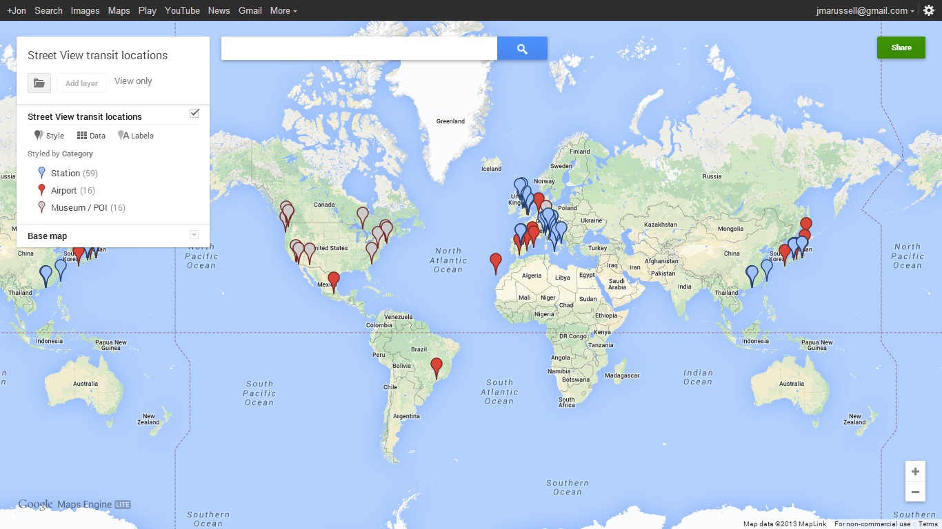
From today, Google Maps features a range of international transit locations, including 16 airports, more than 50 train and subway stations and even details of a cable car station in Hong Kong and the inside of an Emirates A380 plane at Dubai Airport.

Google Maps is already a well-used tool for planning travel — across both short and long distances — so adding images to help users familiarize themselves with their points of transit makes a lot of sense, and is likely to be welcomed by many.
This interactive map shows where the new locations are situated. Right now, there are plenty of gaps but, as ever with Street View imagery, we can expect it to get more comprehensive and useful as Google’s coverage spreads to new locations and regions:
➤ Take off for the holidays with Google Street View [Google Maps blog]
Image via Thinkstock
Get the TNW newsletter
Get the most important tech news in your inbox each week.