Google Maps is showing what appears to be the effects of global warming in southern California.
First spotted by Tech.Mic, Google Maps shows a rising water level in coastal areas of California.
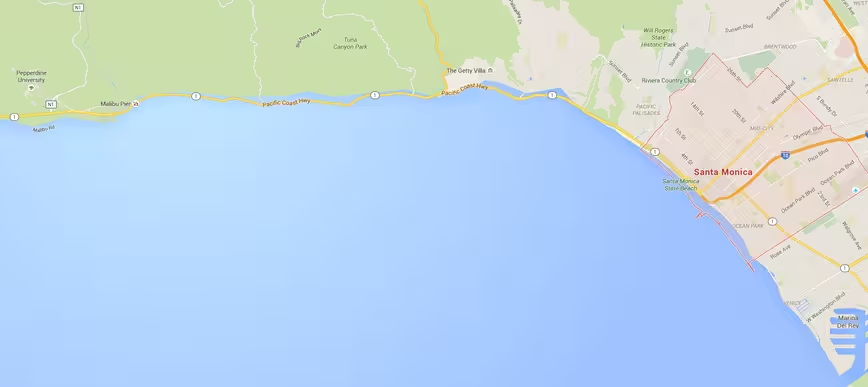
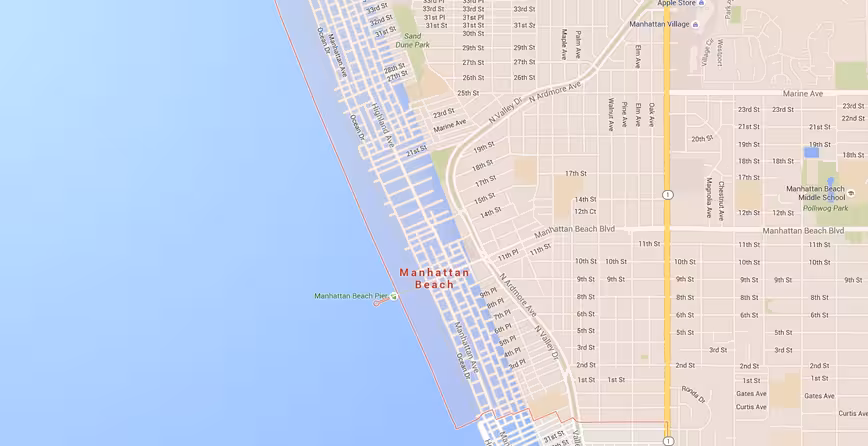
I tested it for myself, and got no immediate results on the desktop version of Google Maps. After zooming out, the new coastline made itself clear. Areas of Santa Monica, Malibu and Manhattan Beach can be seen with encroaching sea levels.
We’ve reached out to Google for comment, and will update should we hear back. Other sites have imagined this type of scenario, but visualizing the effects of global warming in Google Maps is probably much more effective.
➤ Google Maps Now Shows You if Climate Change Will Put Your Home Underwater [Tech.Mic]
Get the TNW newsletter
Get the most important tech news in your inbox each week.