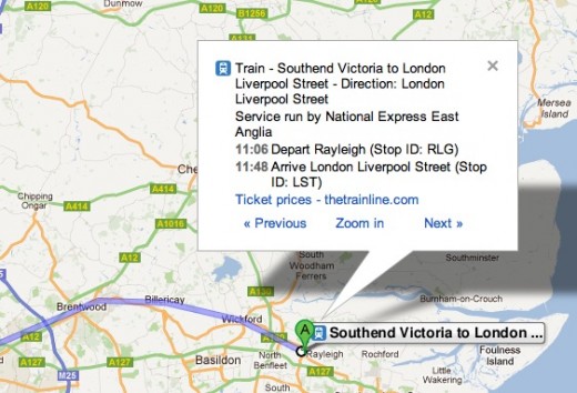
Google has updated its Google Maps Transit website to include National train routes, timetables and directions across England, Scotland and Wales.
In order to roll out the new service, Google has partnered with UK rail travel company Trainline to make over 170,000 routes available to Google Maps users. Google’s map data will now include 2,500 stations, 8,000 bus stops and 250 London Underground routes.
The partnership with Trainline will enable users to buy their tickets but Google doesn’t look to have enabled the option to buy tickets directly for the route that you have planned.
In July 2011, Google enabled London travellers to search for public transport directions within Google Maps, announcing that the 1 billion+ passengers that use Transport for London (TfL) services each year can use its service to find information on 8,000 bus stops and 250+ Underground stations.
The rapid delivery of travel services in the UK sees Google build out its Maps platform in time for the 2012 London Olympics, where millions of spectators are expected to account for a large percentage of the 31 million people expected to visit the UK this year.
Google will not be able to deliver updates on live delays, but it will be able to assist Google Maps users in planning their train journeys via the browser and also via their mobile devices .
Get the TNW newsletter
Get the most important tech news in your inbox each week.


