Google has announced the release of its second wave of Street View images from Israel after the company added 360 degree photography from “hundreds” of new locations in the Middle Eastern country to its Google Maps service.
The first images of Israel emerged last April, which was seven months after Google announced plans to map the country. That decision itself took three months of negotiations with authorities, concerned at the issue of personal data, but now Google is adding to its collection with Street Views photos from hundreds of cities, towns, villages, heritage sites and tourist attractions.
You can now virtually tour the picturesque city of Safed in the North, the coral reef in Eilat in the South, visit the lowest point on earth at the Dead Sea, and wander around the narrow passageways of the old city of Acre.
We’ve added imagery from cities, towns and villages including Ashdod, Ashkelon, Be’er Sheva, Bnei Brak, Eilat, Isfyia, Kfar Qasem, Kiryat Gat, Nazareth, Netanya, Ofakim, Petah Tikva, Rishon LeTsiyon, Sderot, Tira, and many, many more. And stay tuned – we hope to expand coverage to still more of the region’s sites, streets, cities and towns in the future.
Google’s objective with its mapping product is quite simple…cover the world, and it is equally as ambitious with Street View, its program to bring street-level images of cities, towns and beyond to the Web. Due to the vast areas they cover, Street View projects take years to cover countries so the company tends to focus on the largest cities, before expanding out to cover other places. That’s exactly the case for Israel.
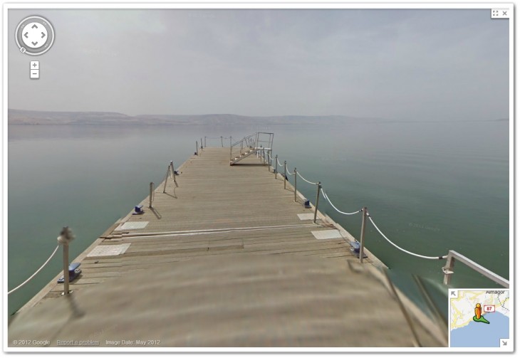
Here are some of the new images that standout, starting with the Sea of Galilee, at Tiberias, where Jesus is said to have walked on water.
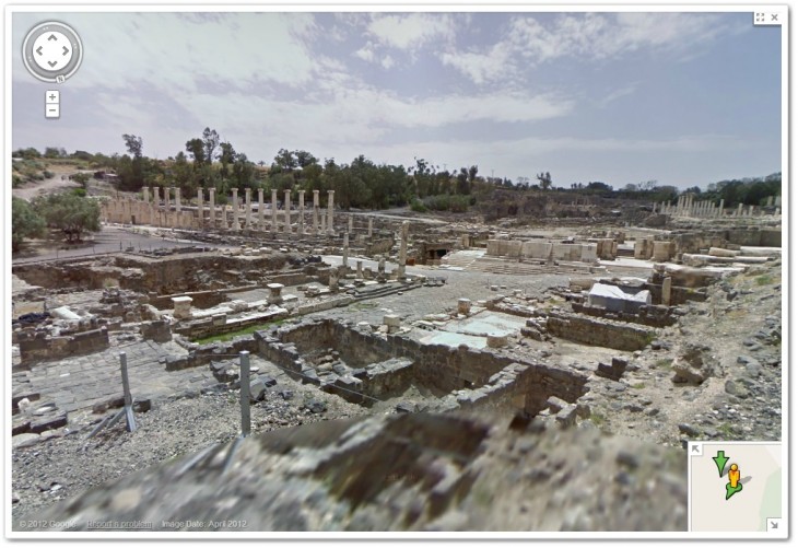
The Bet She’an National Park, one of the world’s largest archaeological sites.
Related: No, Google did not run over a donkey in Botswana
Headline image via Ekaterina Lin / Shutterstock
Get the TNW newsletter
Get the most important tech news in your inbox each week.


