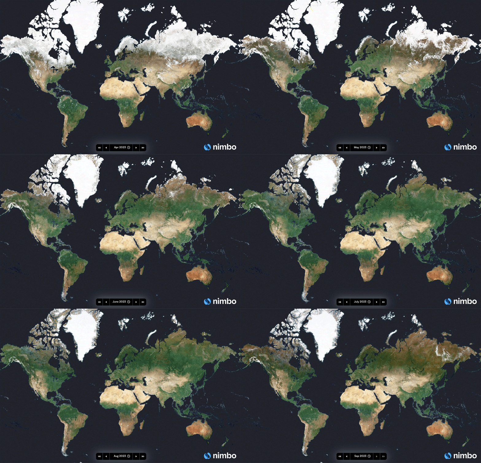
French startup Kermap has developed a ‘digital twin’ of the Earth that claims to offer the most up-to-date views of our home planet.
The programme is called Nimbo Earth Online and it is the only platform providing new satellite views of the world every month, without clouds. Google Earth refreshes its imagery every several months to years, depending on location.
AI-powered
Nimbo’s chronological views of the world rely on Sentinel 1 and 2 satellite images supplied by the EU’s Copernicus programme. The images are available to view in both 2D and 3D.
Clouds are completely removed from the photos through deep-learning techniques. Basically, AI looks for the most recent unclouded image of the same area, and replaces the clouds with that image.
There’s one caveat though: Nimbo offers a resolution of only 10 metres per pixel. This is far less precise thanwhat is offered by Google Earth — so no spying on your neighbours.
But its creators say the real magic of the tool is that it allows you to see how our planet transforms month-to-month — providing unrivalled data for scientists, journalists, environmental professionals or anyone wanting to explore Mother Earth at this time of extreme global change.
Plus the software is open access. Just create a free account and try it for yourself here or check out our quick run-through below.
Our take
We gave the Nimbo a quick run through and we’re honestly quite impressed — even if the startup’s ‘digital twin of the Earth’ claim is a bit far-fetched.
While the quality isn’t as good as Google Earth, it hosts several really cool features that aren’t available on the tech giant’s platform.
This includes a split & swipe function, which allows you to compare before and after images in one single view.
There is also a timelapse feature to capture how a certain geographical location has transformed over months or several years.
The programme offers four data layers: natural, infrared, NDVI (for quantifying the health and density of vegetation) and radar. Radar is particularly useful for applications such as monitoring shipping lanes, tracking wildlife, and mapping the earth’s surface at night.

All these images are available for export straight from the programme onto your computer, free of charge.
There is an unspecified cap on how much you can use Nimbo in one month, however. After that point you will have to opt for one of their paid plans. However, we’ve used the programme quite a lot already and haven’t been cut off — yet.
For us, the biggest downside is that the imagery is only available from 2019, which greatly limits its potential for measuring long-term geographical changes. Hopefully this range will improve as the fledgling company expands its reach.
Kermap’s main customer base are GIS professionals and land managers based in government departments and in academia. It counts the French Ministry for Agriculture and Nestlé among its existing customers.
As climate change accelerates, the startup said it believes that universal access to space data is one of the most precious resources at our disposal to measure, predict, adapt to, and counter climate phenomena.
Get the TNW newsletter
Get the most important tech news in your inbox each week.


