Google is rolling out a slew of aesthetic updates to Maps today, with a view towards better representing the natural landscape.
From today, you’ll start seeing clearer terrain, color gradations for forests and vegetation, and labels for large, natural land formations. This will include forests, deserts and mountain ranges, and will be included as default on the basemaps themselves.
By way of illustration, this is how Southern Asia looked before this information was reeled in:
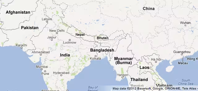
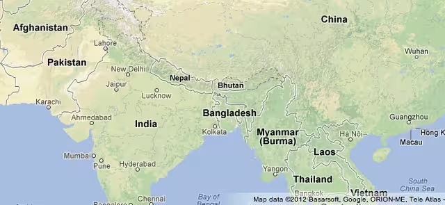
…and this is how it looks after. The color gradients help highlight Pakistan’s deserts, Laos’ jungles and the mountain-laden Himalayas.
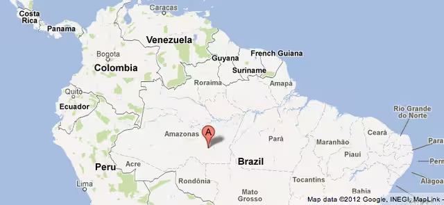
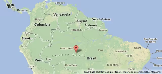
In term of how labels are being used, here’s a ‘before and after’ snapshot of how Google’s basemap looks around the Amazon Basin. You probably knew roughly where it was, but maybe not exactly…
Before…
…and after:
Earlier this week, we reported on Google’s efforts to conquer one of the world’s most majestic places: the Grand Canyon.
To help demonstrate the extent of its efforts to make Maps more complete, the Internet giant compiled a Street View of one of the few places in the world that no car, trike, or snowmobile has ever been before.
Certainly, this latest iteration goes some way towards making the maps “more complete”, and will better depict key differences not only between countries and continents, but also within smaller localized regions.
Get the TNW newsletter
Get the most important tech news in your inbox each week.