Google has announced today that it has updated its 45°, aerial and satellite imagery for a combined 224 cities and 108 countries. The new imagery only serves to emphasize just how dominant that Google is in this arena, with an enormous amount of coverage.
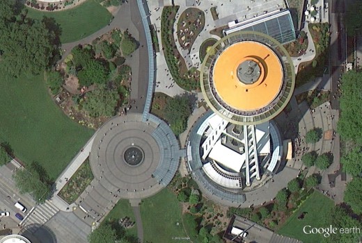
The new aerial and satellite images include 164 cities and 108 countries or regions. The updated imagery is being included in both Google Maps and Google Earth now, as the company works to combine the separate code bases of the apps into a single one that it can use to speed the development of its apps for Android and soon, iOS. The Space Needle in Seattle is one example of the new aerial imagery:
The 45 degree imagery in Google Maps has also gotten 40 more US cities and 20 more internationally. Luxembourg and Romania are included for the first time ever.
Notably, Google isn’t announcing a huge expansion of its 3D imagery, which is gathered by a fleet of planes and currently exists only in its Google Earth product, not in Google Maps on mobile. Still, the area update today is still very extensive. For a list of all of the many, many new cities and regions check out Google’s blog post here.
Image Credit: Adam Berry/Getty Images
Get the TNW newsletter
Get the most important tech news in your inbox each week.


