One of the handiest features of Google Maps is that it uses real-time traffic data to tell you how long it will take to get from point A to point B. Without that feature, every ride would probably take 20 minutes longer than you anticipated, depending on the time of day and conditions on the road.
The company first rolled out the feature in 2008 and has worked to expand the locations that it covers. A big part of the coverage area has to do with people participating in “crowdsourcing” their location data when they’re driving somewhere. When you use Google Maps on your mobile device, it gives constant updates to the company on your progress. Google then crunches all of that data to accurately predict traffic conditions in near real-time.
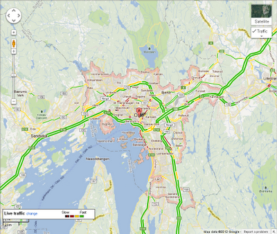
The Maps team has announced that it now has traffic condition coverage for Norway, New Zealand, and Hong Kong to go along with the United States and 13 other European countries.
Using Google Maps on a mobile phone running Android is a huge selling point for the device, but it appears that Google might be losing its foothold on running the Maps app on iOS.
The mobile version of Maps runs seamlessly in the browser though, so have no fear.
I’ve found that Google Maps does a pretty good job predicting traffic unless there’s a major accident, in which case there’s pretty much nothing any company can do to keep you in the know on how long you’re going to be sitting still in your car.
Maybe one day when Google’s self-driving cars hit the market, we’ll never have to worry about checking out maps or driving ever again.
Get the TNW newsletter
Get the most important tech news in your inbox each week.


