 Geotagging your photos can be a really useful way of keeping track of where they were taken.
It’s a simple task with most mobile phones as they’re location-aware, but adding geodata to photos taken with most ‘normal’ cameras is usually a case of manually dragging them onto a map with your favourite photo library software – a real pain if you have a lot of images to tag.
Now Google has mashed together two of its less well-known services, Panaramio and Latitude, to make the process a lot easier, albeit with a couple of caveats. Here’s how it works…
You go out and about with Latitude running on your phone, automatically pinging your location back to Google as you go. Just take photos with your stand-alone camera, not worrying about exactly where you are at the time – Latitude is sorting out that bit.
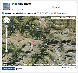
Then, when you’re back home you connect your Panaramio account to your Latitude history and import the photos you took with your camera. Panaramio can then cross-reference the time and date that the photos were taken with where you were at that time from your Latitude location history, automatically geotagging all the photos!
You can then view the photos in Google Earth, in the locations they were taken – or on a Panaramio map that you can embed into other web pages.
Unfortunately, the kicker is that there’s no way to then export the geotagged photos from Panaramio. Hopefully Google will add similar capabilities to its Picasa image library service soon, although it hasn’t confirmed that such a move is on the way. For now, this Quora thread suggests a few alternative ways of auto-geotagging, but they’re a bit more complex than this simple solution.
You can read more about this new feature on its Panaramio Help page.
Get the TNW newsletter
Get the most important tech news in your inbox each week.


