
Trulia, an online marketplace to help you find your next home, has released an update to its natural hazard map that now includes data around hurricanes, wildfires, and tornadoes. Potential home buyers can scan to survey what potential disasters await them if they move to a particular part of the United States.
These three natural phenomena come several months after Trulia launched its hazard map in May.
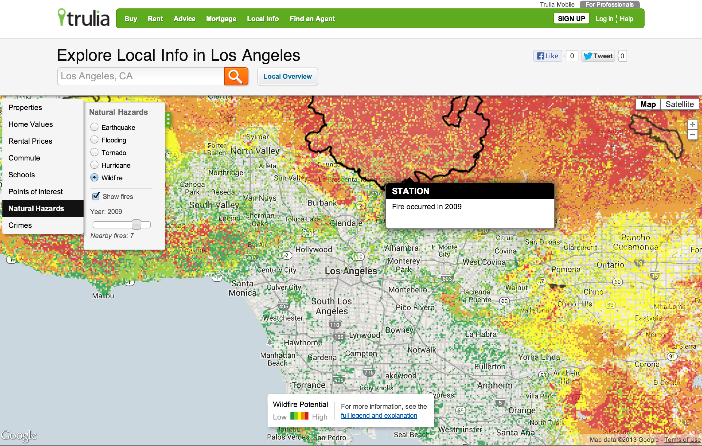
Using government-provided data, the company has overlaid the information on a map that illustrates in which part of a particular city, state, region, or the country most prone to flooding, wildfires, tornadoes, and earthquakes.
Los Angeles and most of Southern California is an area hardest hit by wildfires. Using Trulia’s map, a buyer could not only see the likelihood of what they might encounter if they move to the area, but see past occurrences — the service also highlights the perimeter of the fire so you can see the scope of past events.
As mentioned earlier, data used by Trulia is provided from government agencies. With respect to hurricanes, the company is using information from the National Oceanic and Atmospheric Administration (NOAA) from 1950 to 2012. Wildfire data comes from the US Forest Service and goes as far back as 2001. Tornado patterns are from NOAA and displays the Enhanced Fujita Scale while tracking storms from 1950 to 2011.

So where are the least hazard-prone areas of the US? The company says that Syracuse, NY ranks as the number one housing market at low-risk, followed by Cleveland, Ohio, Akron, Ohio, Buffalo, New York, and Bethesda-Rockville-Frederick, Maryland.
Trulia says that this data will be integrated into its search engine so that when you view a specific property, it will display any applicable hazards that are associated with it.
The maps are free to use by anyone, but are only available on through the Web browser. It’s limited to providing data only in the US.
➤ Trulia natural hazard visualization map
Photo credit: David McNew/Getty Images
Get the TNW newsletter
Get the most important tech news in your inbox each week.