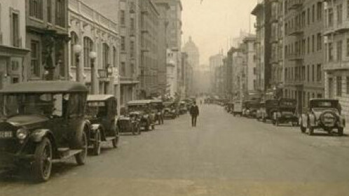
We’ve seen plenty of Google Maps mashups over the past few years, but this has to be one of the best. What Was There is designed as a “Virtual time machine” that lets you explore the world as it used to look via maps of familiar places and geotagged, historical photographs.
From the Explore Photos page you can move around the world to find places you’re interested in and then view photographs of what they looked like many decades ago. You can even overlay the old photograph onto Street View to compare today’s scene with the past.
If you have any interest in history at all, it’s fascinating to explore. Major US cities currently have the best coverage – particularly San Francisco, Chicago and New York – although Europe is pretty well represented too. The good news is that anyone can upload images to the site, so if you’re sitting on some old photos of your home town that you inherited from a relative, why not upload them to help make the site even better?
The logical next step for a site like this is to somehow map the historical photos onto the fully interactive version of Street View. At present the Street View overlay here is purely static. Perhaps Google could develop such a project. “Google History View” – now that would be fascinating.


The <3 of EU tech
The latest rumblings from the EU tech scene, a story from our wise ol' founder Boris, and some questionable AI art. It's free, every week, in your inbox. Sign up now!

Get the TNW newsletter
Get the most important tech news in your inbox each week.